
The West-India atlas: or, a compendious description of the West-Indies: illustrated with forty correct charts and maps, taken from actual surveys. Together with an historical account of the several countries and islands which compose that part of the

ReadAboutContentsHelp
Thomas Jefferys, "Geographer to King George III", was an English cartographer who was the leading map supplier of his day. He engraved and printed maps for government and other official bodies and produced a wide range of commercial maps and atlases, especially of North America.

Pages

Sequence 56
Not Started

Sequence 56

This page is not transcribed, please help transcribe this page

Sequence 57
Not Started

Sequence 57

This page is not transcribed, please help transcribe this page
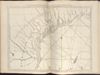
Sequence 58
Not Started

Sequence 58

This page is not transcribed, please help transcribe this page

Sequence 59
Not Started

Sequence 59

This page is not transcribed, please help transcribe this page

Sequence 60
Not Started

Sequence 60

This page is not transcribed, please help transcribe this page

Displaying pages 56 - 60 of 152 in total